| Bay Jimmy HSI Data Fusion |
|
Click here to download the data fusion HSI image cube file
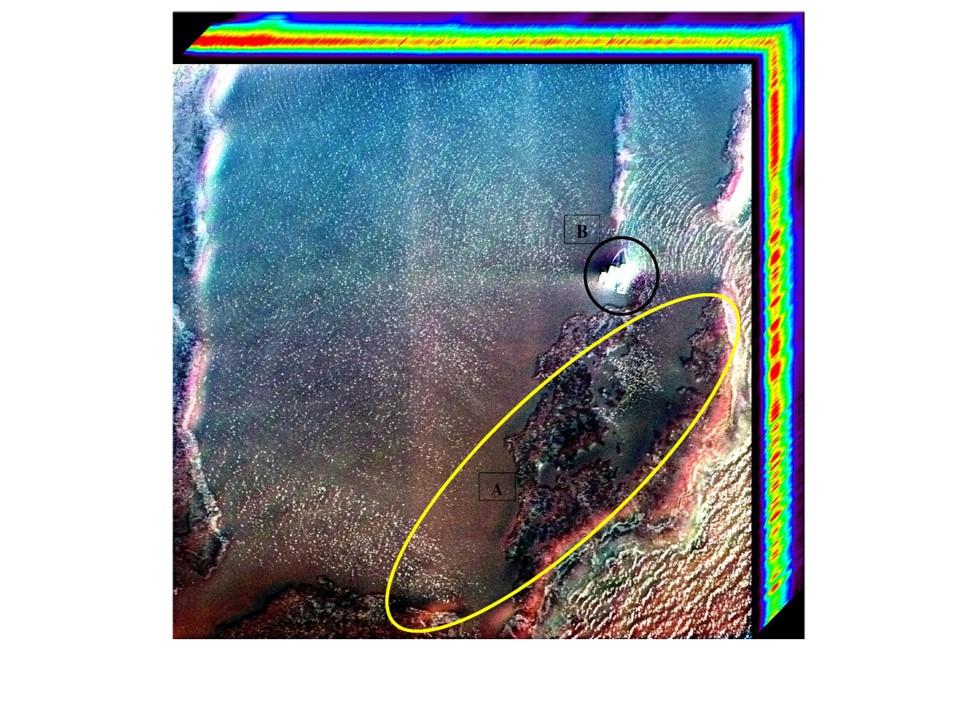
An airborne hyperspectral data fusion "image cube" - RGB display. The image subset
shown above is a "data fusion" of a scanned AGFA color negative image with ~10 cm pixel (GSD) spatial resolution
and a hyperspectral airborne image scene with ~ 0.5 m pixel (GSD) collected on March 21, 2011. Weathered oil is visible in
the coastal littoral zone and marsh area (A) in the Northern Gulf of Mexico. A restoration surface vessel (B), not observable
in the raw hyperspectral image is visible in the fused hyperspectral image collected by Dr. Bostater, Marine & Environmental
Optics Laboratory.
Dr. Charles Bostater
321-258-9134
|